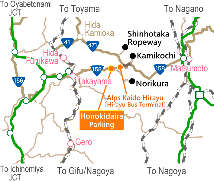
From Takayama or Honoki Daira to Norikura
If you are boarding from Takayama Nohi Bus Center, Hirayu Onsen, Akandana Parking Area, Hounoki-daira, or Shin-Hotaka Ropeway, please purchase your ticket in advance at the ticket window or vending machine. (If the ticket window or vending machine is closed, please pay on board the bus.)
Please refrain from boarding while wearing ski boots or spiked shoes.
Please change into different shoes before boarding.
Mt. Norikuradake is located at the southern edge of the Northern Alps (Hida Mountains) and is the collective name for the mountains with the highest peak of Mt. Kengamine (3,026 m). It includes 23 peaks, 7 lakes and 8 plains, and the foot of the mountains lies between Takayama City and Matsumoto City. It is called "Norikura" (a riding saddle) because when seen from Hida Takayama City, it looks like a saddle on a horse.
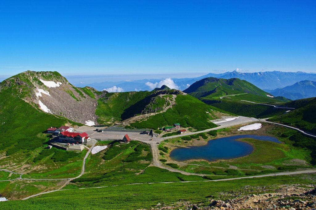
By shuttle bus from Hirayu Hot Spring/Honoki Daira to Tatamidaira, the top of Mt. Norikuradake, via Norikura Skyline with the beautiful landscape, it takes about 60 minutes, and it is only operated during limited periods. Tatamidaira is the last stop, and at an altitude of 2,702 m which the "highest altitude bus stop in Japan." This is an attractive tourist spot where you can enjoy hiking around the flower garden with blooming alpine plants or climbing a 3,000-m mountain casually.
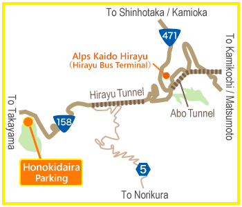
Access Map
Mt. Norikura is closed to private vehicles year-round in order to protect the beautiful natural environment of the region.
If you are driving, please park your car at the Honokidaira Parking Lot (free of charge) and take the bus.
Timetable
Hirayu Onsen/Honoki DairaNorikura
【Type A】
| Hirauyu Onsen | 8:35 | 9:35 | |||||||||
| Honokidaira | 7:55 | 8:30 | 8:55 | 9:30 | 9:55 | 10:30 | 10:55 | 11:55 | 12:55 | 13:55 | 14:55 |
| Norikura Tatamidaira | 8:40 | 9:15 | 9:40 | 10:15 | 10:40 | 11:15 | 11:40 | 12:40 | 13:40 | 14:40 | 15:40 |
【Type B】
| Hirauyu Onsen | 8:35 | 9:35 | ||||||
| Honokidaira | 7:55 | 8:55 | 9:55 | 10:55 | 11:55 | 12:55 | 13:55 | 14:55 |
| Norikura Tatamidaira | 8:40 | 9:40 | 10:40 | 11:40 | 12:40 | 13:40 | 14:40 | 15:40 |
【Type C】
| Hirauyu Onsen | 8:35 | |||
| Honokidaira | 7:55 | 8:55 | 12:55 | 13:55 |
| Norikura Tatamidaira | 8:40 | 9:40 | 13:40 | 14:40 |
NorikuraHirayu Onsen/Honoki Daira
【Type A】
| Norikura Tatamidaira | 8:55 | 9:30 | 9:55 | 10:30 | 10:55 | 11:55 | 12:30 | 12:55 | 13:30 | 13:55 | 14:30 | 14:55 | 15:30 | 15:55 |
| Honokidaira | 9:40 | 10:15 | 10:40 | 11:15 | 11:40 | 12:40 | 13:15 | 13:40 | 14:15 | 14:40 | 15:15 | 15:40 | 16:15 | 16:40 |
| Hirauyu Onsen | 16:00 | 17:00 |
【Type B】
| Norikura Tatamidaira | 8:55 | 9:55 | 10:55 | 11:55 | 12:55 | 13:55 | 14:55 | 15:55 |
| Honokidaira | 9:40 | 10:40 | 11:40 | 12:40 | 13:40 | 14:40 | 15:40 | 16:40 |
| Hirauyu Onsen | 16:00 | 17:00 |
【Rainy weather schedule】
| Norikura Tatamidaira | 8:55 | 9:55 | 13:55 | 14:55 |
| Honokidaira | 9:40 | 10:40 | 14:40 | 15:40 |
| Hirauyu Onsen | 16:00 |
【Operating Calendar】
| 5/15~7/17 | 7/18~8/23 | 8/24~10/12 | 10/13~18 | 10/19~31 | ||
|---|---|---|---|---|---|---|
| Weekdays | Sat,Sun&Holidays | |||||
| Sunny Day | B | A | B | A | B | C |
| Rainy Day | C | |||||
Bus Fare
| Hirayu Onsen(Transfer at Honokidaira) Honokidaira |
Takayama Nohi Bus Terminal Hirayu Onsen(Transfer at Honokidaira) |
||
|---|---|---|---|
| one way | round trip | round trip | |
| Norikura Tatamidaira | 1,800yen | 3,400yen | 5,700yen |
Tourists spots
Mt. Kengamine
About an hour and a half one way on foot from Tatamidaira,and the altitude is 3,026 m
Mt. Kengamine is the highest peak of Mt. Norikuradake, one of the 100 Famous Japanese Mountains and a popular mountain where people can easily challenge climbing a 3,000-m mountain. Mt. Yarigatake (3,180 m, 5th highest mountain in Japan), Mt. Okuhotakadake (3,180 m, 3rd highest mountain in Japan), Mt. Hakusan (2,702 m), Mt. Ontake (3,067 m) or even the far away Mt. Fuji (3,776 m, highest mountain in Japan) can be viewed from the mountaintop on a bright sunny day if you are lucky. The mystical deep blue crater lake, Gongen Pond, can be also observed on the way.
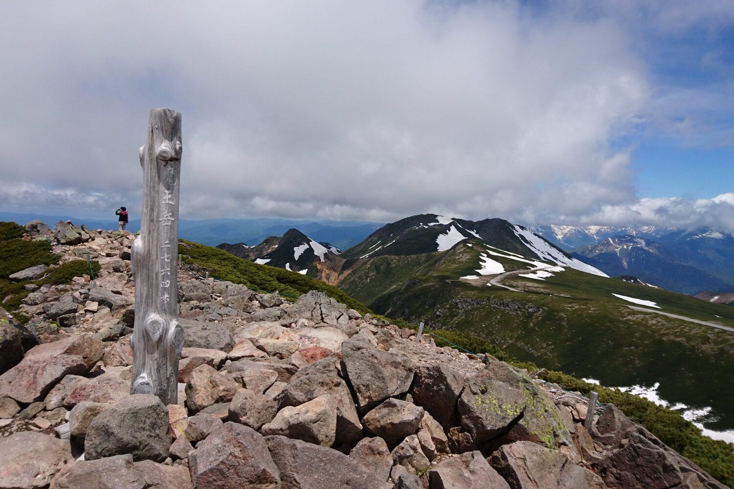
Mt. Maoudake
About 15 minutes one way on foot from Tatamidaira,and the altitude is 2,763 m
Mt. Maoudake is the nearest mountain from Tatamidaira and you can climb to the mountaintop relatively easily as steps are prepared close to the top. Mt. Kengamine and the Hotaka mountain ranges, and the vast panoramic, curvy Norikura Skyline below can be viewed from the mountaintop.
Mt. Daikokudake
About 20 minutes one way on foot from Tatamidaira,and the altitude is 2,772 m
Climbing Mt. Daikokutake became easier than before as the climbing route to the mountaintop was maintained from the bus stop "Mt. Daikokutake trailhead" newly established in September 1, 2016. From the mountaintop, you can enjoy the view of Mt. Yakedake (2,455 m) smoking, the majestic Hotaka mountain ranges or the mystical rising sun early in the morning.
Mt. Fujimidake
About 25 minutes one way on foot from Tatamidaira,and the altitude is 2,817 m
Although the climbing route is arranged to the mountaintop in Mt. Fujimidake, you may have to pay attention to the rock-strewn part near the top. The mountains of Northern Alps, Kiezugaike Pond with snow remaining in the gorge depending on the season and the Tatamidaira area can be observed from the mountaintop. Also, this is the viewing spot of the rising sun.
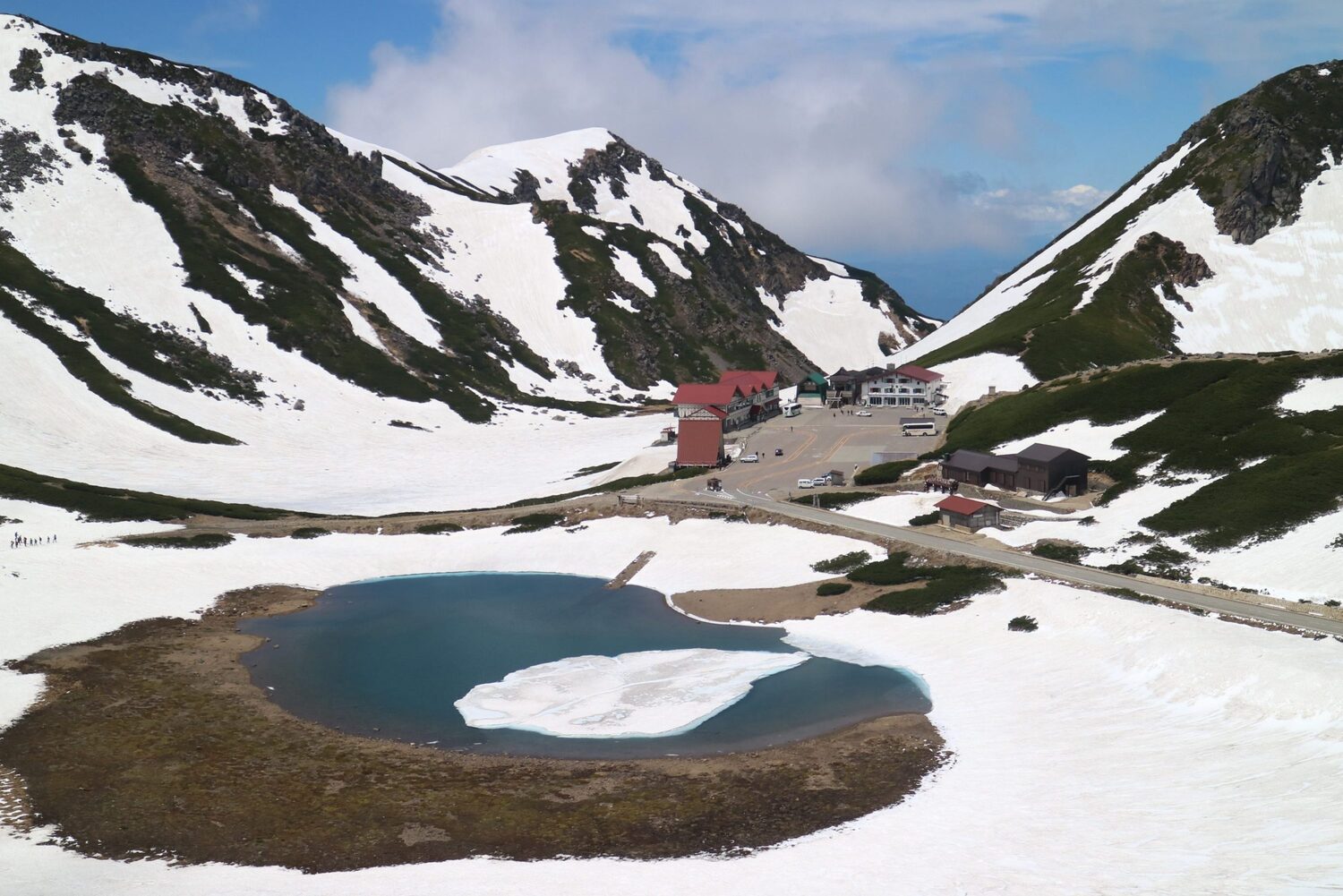
Tsurugaike Pond
About 5 minutes one way on foot from Tatamidair
Tsurugaike Pond is located near Tatamidaira bus terminal, it became popular as its shape looks like a "Tsuru" (crane). You can view its beautiful shape reflecting the blue sky on its surface on a bright day.
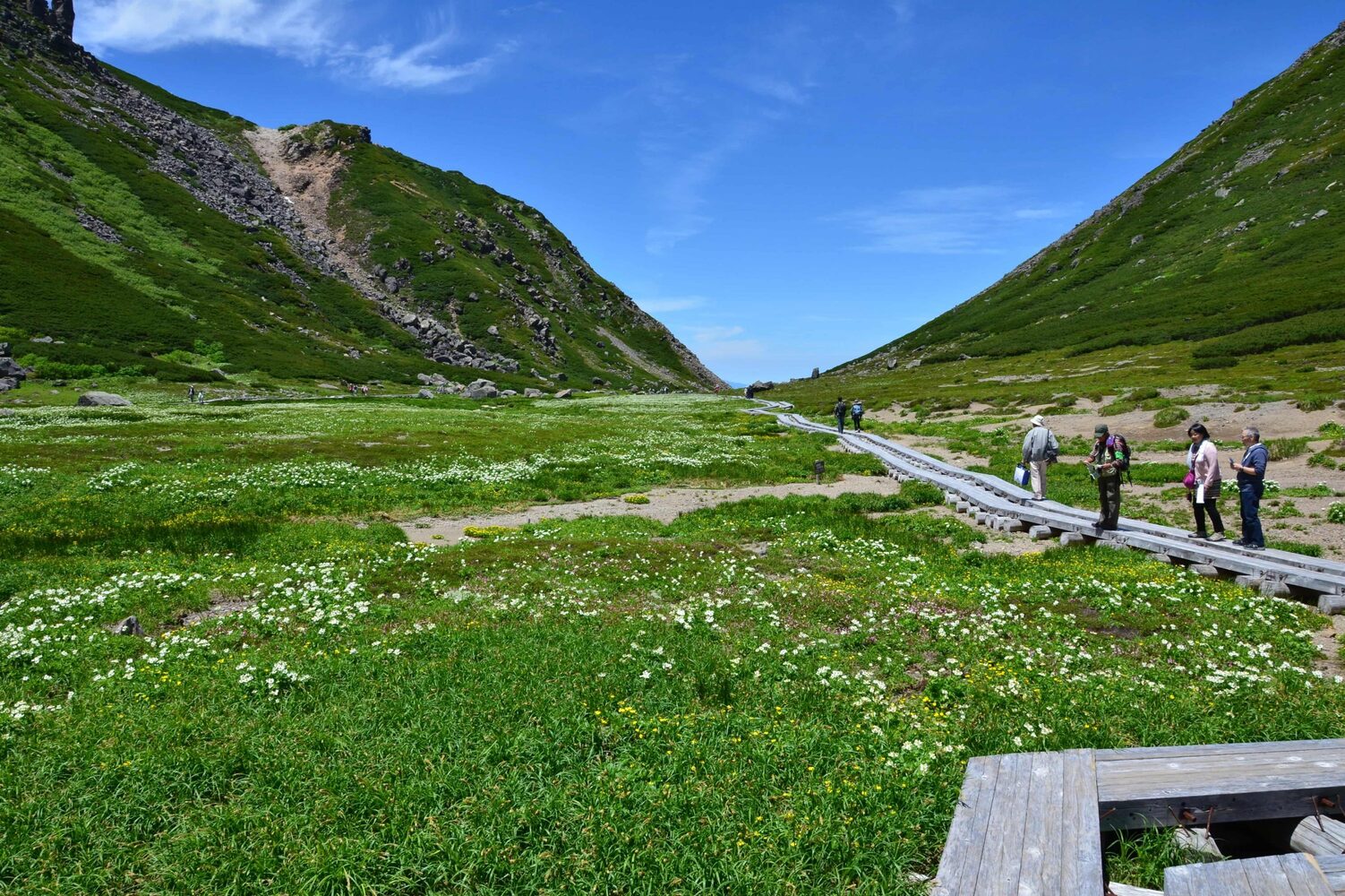
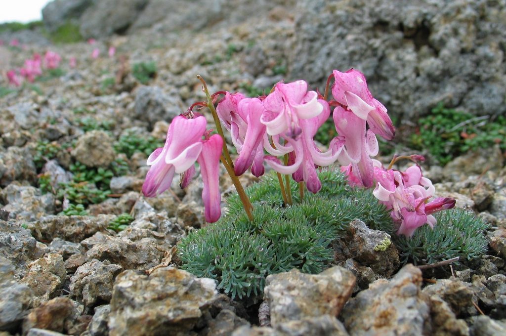
Ohanabatake: Norikura’s Alpine Flower Garden
Ohanabatake, meaning “field of flowers,” is Mt. Norikura’s alpine flower paradise. Just a few minutes’ walk from the Norikura Bus Terminal, this natural garden is nestled in a hollow between two peaks. Its level terrain and wooden boardwalk give easy access to visitors of all ages and ability levels. Many flower varieties are in bloom during Mt. Norikura’s short summer, from mid-July to mid-August.
One of Ohanabatake’s most prominent species is the deciduous shrub known as Aleutian avens (chinguruma), whose flowers have creamy white petals and a bright yellow center. Like many alpine plants, it is small and appears delicate, but is actually hardy enough to withstand the severe winds, deep snows, and intense sunlight of an environment 2,680 meters above sea level. In autumn, Aleutian avens is transformed: its green leaves turn red, and the developing seeds sprout pink-and-white, frond-like filaments reminiscent of waving sea grasses.
The narcissus anemone (hakusanichige), another yellow-and-white flower, grows in clusters reaching 30 to 60 centimeters high. The white “petals” of its blooms are actually sepals—the leaf-like structures at the base of flowers where the stem attaches. The sepals of most flower species are green, not white, but those of the narcissus anemone have evolved to mimic white petals. There is also a rare form of the plant with sepals that retain patches of greenish-yellow. Narcissus anemone is a favorite of bees and butterflies.
The Kamchatka lily (kuroyuri) is easy to spot. Its tall stems are topped by blackish-purple flowers, sometimes dappled with yellow. In English, the species is known by many different names, not all of them flattering. In addition to “chocolate lily” and “wild rice,” it may also be called “outhouse lily,” “skunk lily,” and “dirty diaper.” These nicknames come from its smell, which varies in strength but is generally unpleasant. Even so, the odor serves a useful purpose—it attracts flies, which are the flower’s main means of pollination.
A full circuit of the boardwalk takes 30 to 40 minutes, but visitors may wish to spend longer examining and photographing the more than 30 alpine species at close range.
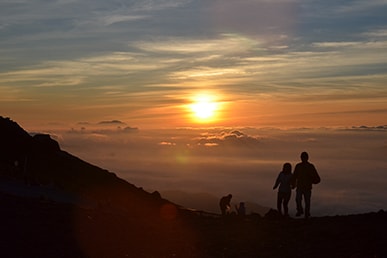
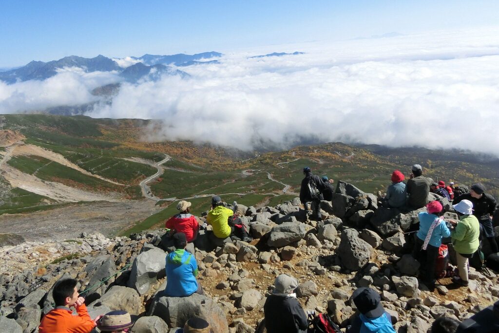
Greeting the Rising Sun
Since before recorded history, mountain ascetics, monks, and devoted laypeople have climbed Japan’s high peaks to meditate, pray, and witness that most uplifting and spiritual of sights: the morning sun rising above the clouds in a flash of golden light.
Viewing the sunrise from a high mountaintop holds significance in both Japanese spiritual belief and the national consciousness. In Shinto, the sun is revered as Amaterasu Ōmikami, ruler of the heavenly realm and ancestress of the imperial family. In Japanese Esoteric Buddhism, the sun is associated with Dainichi Nyorai, the Cosmic Buddha, whose name means “Great Sun.” Furthermore, Japan’s well-known moniker “Land of the Rising Sun” has a surprisingly ancient history. As early as 607 CE, ruling regent Prince Shōtoku (574–622) wrote to the Chinese imperial court using the salutation “From the Sovereign of the Land of the Rising Sun.” Fourteen centuries later, veneration of the rising sun remains a part of the country’s cultural, historical, and spiritual identity.
Today, visitors can experience a mountaintop sunrise from the highest point of Mt. Norikura without facing the dangers or hardships experienced by early climbers. Sunrise shuttle buses run from late July to mid-September, departing well before daybreak from bus stations in both Nagano and Gifu Prefectures. The ride to Tatamidaira Bus Terminal near the summit takes between 50 and 60 minutes from either prefecture. From Tatamidaira, a comparatively easy hike to the mountain’s highest point (Mt. Kengamine, 3,026 m) takes about 90 minutes. Trips are timed so visitors can arrive by sunrise.
English-language announcements on the bus offer advice on mountain safety and tips on which items to carry to the summit. (Unneeded gear can be left in coin lockers at the Tatamidaira Bus Terminal.) When packing for the experience, visitors should note that mountaintop conditions can be quite chilly even in midsummer.
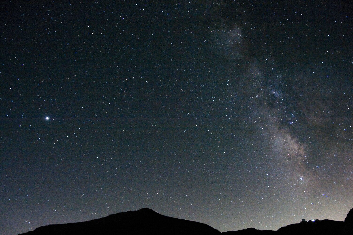
Stargazing on Mt. Norikura
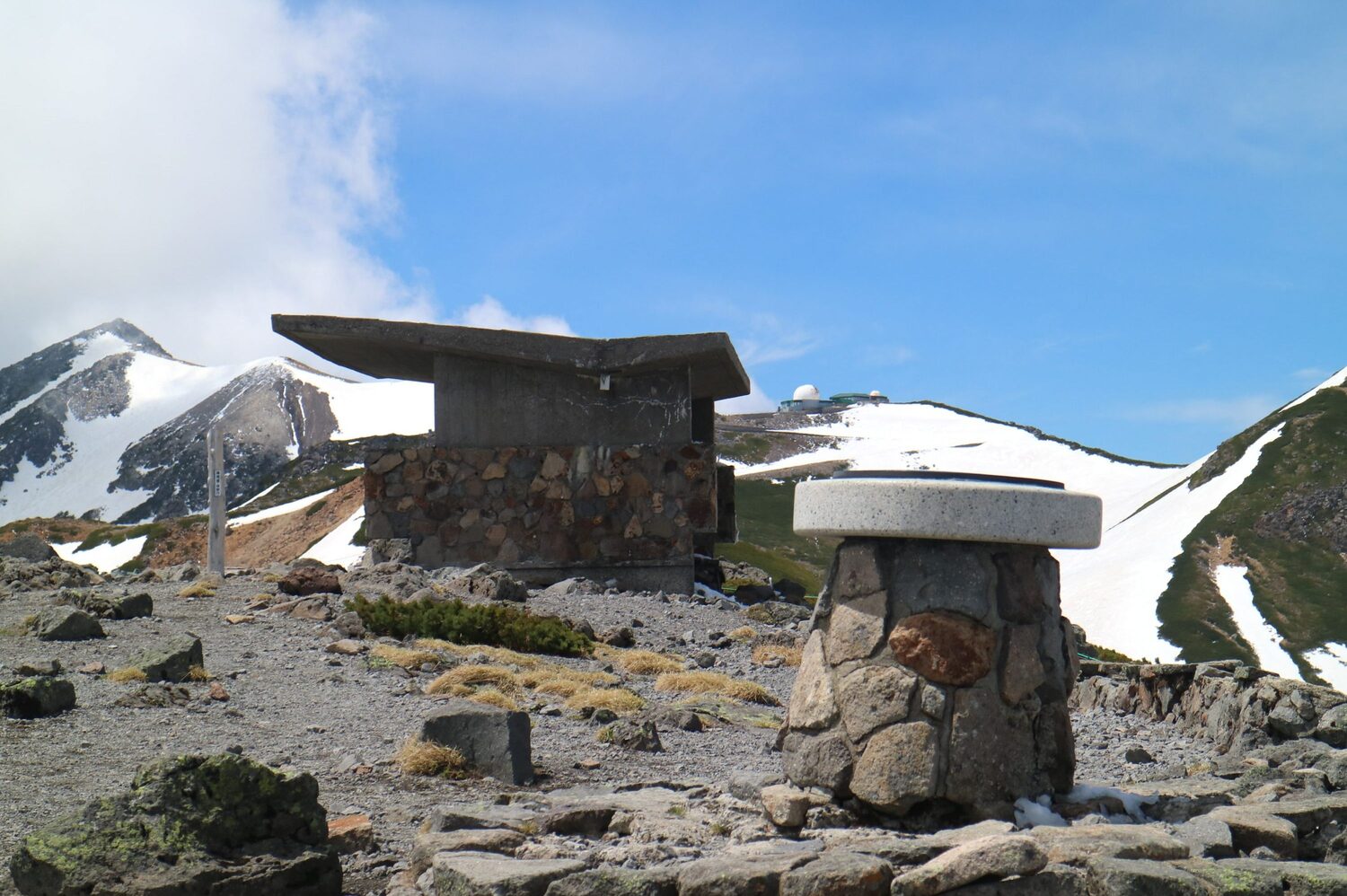
In 1949, cosmic ray researchers at Osaka City University searched Japan’s mountains for the perfect location to conduct experiments monitoring the farthest reaches of space. They ultimately chose Mt. Norikura’s alpine plateau, Tatamidaira, for its high altitude and exceptionally clear skies. In 1953, the Cosmic Ray Observatory of the University of Tokyo (now the Norikura Observatory) was built on the site. Since then, Mt. Norikura has been a favorite destination for professional and hobbyist astronomers seeking extraordinary views of the night sky.
When the weather is favorable, the conditions for stargazing on Mt. Norikura are perfect. Tatamidaira is in a basin surrounded by mountain ridges, so it is shielded from the nighttime lights of neighboring cities like Matsumoto and Takayama. Compared to similar high-altitude sites, access to the plateau is also excellent. Regular buses run from both Matsumoto and Takayama to the Norikura Bus Terminal (2,702 m).
The last buses depart Tatamidaira before dark, so hopeful stargazers should plan on an overnight stay at one of the mountain’s lodgings: Norikura Haku’unsō, Norikura Ginreisō, or Kata no Koya Mountain Hut. The accommodations are affordable, comfortable, and convenient, and some have telescopes and star charts available for visitor use.
Visibility and photography are best when the moon is new.
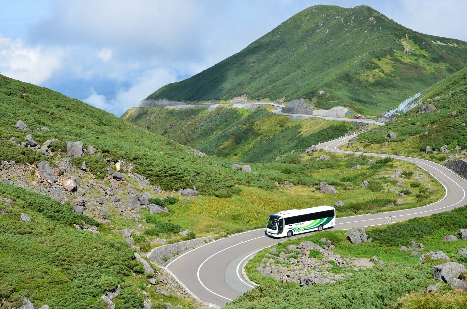
Norikura Skyline
Norikura Skyline is the 14.4 km mountain tourist road from Hirayutoge Pass, 1,684 meters high, to Norikura mountaintop Tatamidaira. It was a toll road for 30 years from 1973 but became open to the public at no charge on October 31, 2002 and restricted the private vehicle use in 2003 to eliminate the traffic congestion and to protect the natural environment allowing only buses, taxis and bicycles to pass through.
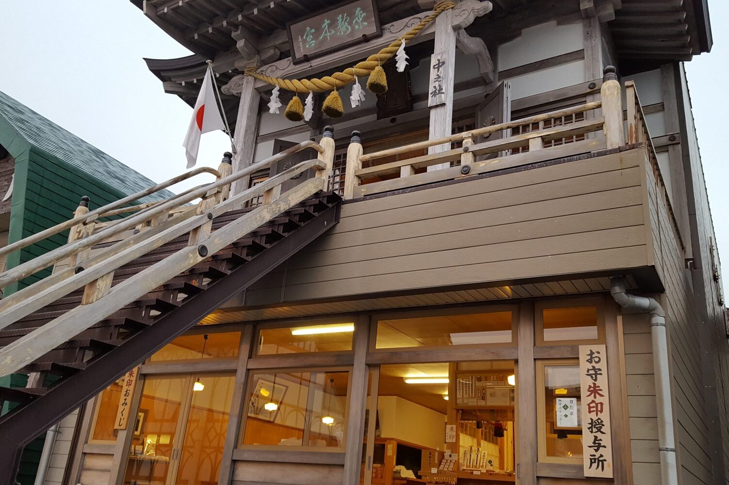
Norikura Hongū Shrine
The main sanctuary of Norikura Hongū Shrine is located at the top of Mt. Kengamine (3,026 m), Mt. Norikura’s highest peak. It is an ancient spiritual site, revered by centuries of pilgrims and hikers. The simple wooden structure enshrines Amaterasu Ōmikami, goddess of the sun and the most important Shinto deity. Amaterasu is thought to protect those who climb to the summit and pay homage at the shrine. Many hikers ascend before dawn to watch the sunrise and feel the deity’s presence as the sun’s first rays light up the mountaintop.
Originally known as Kuragamine Shrine, Norikura Hongū Shrine has existed in some form for over 800 years. In 1181, a retainer of the renowned military commander Kiso Yoshinaka (1154–1184) climbed the peak and enshrined a golden statue there, praying for luck in the Genpei War. Ascetic priest, poet, and sculptor Enkū (1632–1695) is also said to have climbed the peak to offer his prayers. The shrine was renamed Norikura Hongū Shrine in 1949, the same year the current structure was built.
The hike from Norikura Bus Terminal to Norikura Hongū Shrine takes approximately 1.5 to 2 hours, roughly 3 hours roundtrip. Alternatively, visitors can pay their respects without climbing Mt. Kengamine. Within the bus terminal parking area is another small shrine—Norikura Hongū’s yōhaisho, a worship site created for those unable to make it to the mountain peak. Also known as Naka no Yashiro (“middle shrine”), it was built in 1953 to offer prayers for the safety of climbers and visitors to Norikura. The current structure dates to 1974.
Alpine Animals of Mt. Norikura
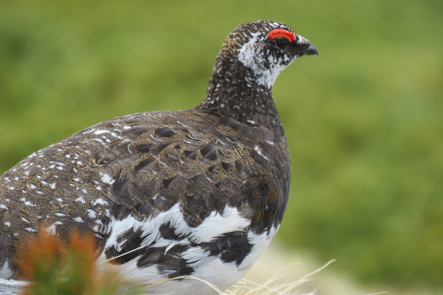
The high mountain slopes of Mt. Norikura teem with mammals, birds, and insects that have adapted to survive at high altitude. Most celebrated is the protected rock ptarmigan (raichō), but there are dozens of alpine species to admire.
The rock ptarmigan is the prefectural bird of both Gifu and Nagano Prefectures. These largely ground-dwelling birds rely on ground cover and camouflage for defense, changing plumage with the seasons. In spring, male birds are easier to spot than females. Their upper half is splotched gray, brown, and black, while their belly and wings are white; they also sport a red comb. Females in summer plumage are almost entirely a mottled brown. In winter, both sexes turn white apart from a black eye stripe and outer tail feathers. Males give an unusual croaking call.
The brown-and-white spotted nutcracker (hoshigarasu) depends heavily on shrub-like Siberian dwarf pines for food. The bird has a throat sack below its bill that can carry up to 200 pine seeds at once, allowing it to forage at length before returning to feed its young. The bird hides food across the mountain in places that it can later detect with 70 to 80 percent accuracy. The seeds that it misses germinate and grow, giving it the nickname “dwarf pine planter.”
Japan’s smallest bird is the goldcrest (kikuitadaki), which has white around its eyes and a striking yellow crest that is brightest in males; they raise the crest when disturbed or when seeking a mate. Though it weighs only about 5 grams, it can survive in this harsh climate.
Other species to seek out are the shy Japanese accentor (kayakuguri), which hides in the dwarf pines, and its lookalike, the yellow-billed alpine accentor (iwahibari), a gregarious bird that is little bothered by the presence of humans.
Mammals on Mt. Norikura include the ermine (okojo), which is brown with a white belly in spring, but turns entirely white in winter except for a tiny black spot on the tip of its tail. Asiatic black bears (tsuki no waguma) are also frequently spotted, and lodgings on Mt. Norikura often post charts with recent bear sightings. If you encounter a bear, keep a distance of at least 100 meters and be sure to avoid flash photography, which could prompt an attack.
乗鞍の豆知識
高山病にご注意を
標高差1,500mなので、気圧も変わります。
下界が1,000hpa(ヘクトパスカル)の時、乗鞍畳平は約730hpa!お湯は92℃~93℃で沸騰します。気圧が低いということは空気の量が少なくなるということで、ポテトチップスの袋がパンパンに膨れ上がったり、軽い頭痛(高山病)が起きたりします。山頂では走ったりせず、ゆったりと過ごしましょう!
真夏でも涼しく快適です
標高が100m高くになるにつれて温度は0.6℃下がると言われています。高山市内(古い町並み周辺)は標高約570mでその標高差は約2,100m。高山市内が30℃のとき乗鞍畳平は17℃~18℃と20℃を上回ることはめったにありません。
※乗鞍岳は、真夏でもとても風が強く寒いことがあります。畳平(バスの終着点)付近の散策程度なら問題ありませんが、長い時間滞在する場合は注意が必要です。手軽に3,000m級の山に登ることができることで有名な乗鞍岳ですが、天候が急変しやすいため、雨具や防寒具は必ずご持参ください。
シラカバとダケカンバの違いは?
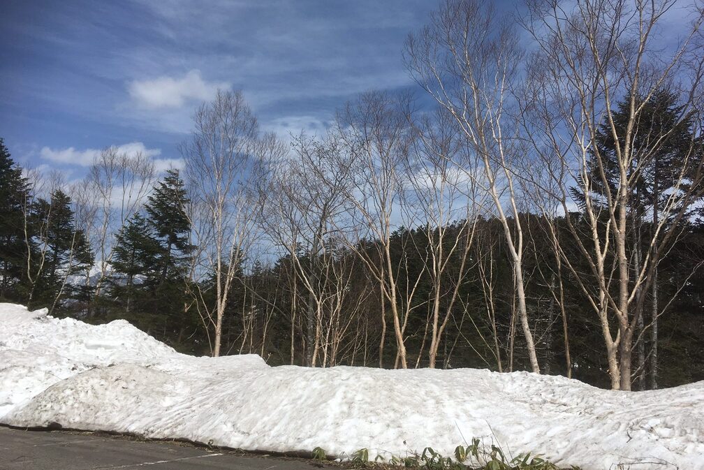
乗鞍への路線バスに乗っていると、周りの景色がどんどん変わっていきます。
ほおのき平付近は、通常の森林風景ですが、平湯峠手前あたりは、白い幹の白樺とクマザサが、平湯峠を過ぎるとダケカンバが多く見られるようになります。
ダケカンバもシラカバもよく似ている木ですが、見分け方はとっても簡単。シラカバは樹皮が白く標高1,000m~1,500m付近、ダケカンバは少し赤茶色の樹皮が特徴で標高1,500m~2,500m付近に生えています。
この2つの樹木で、どの位の高さまで登ってきたのかを知ることができます。
森林限界
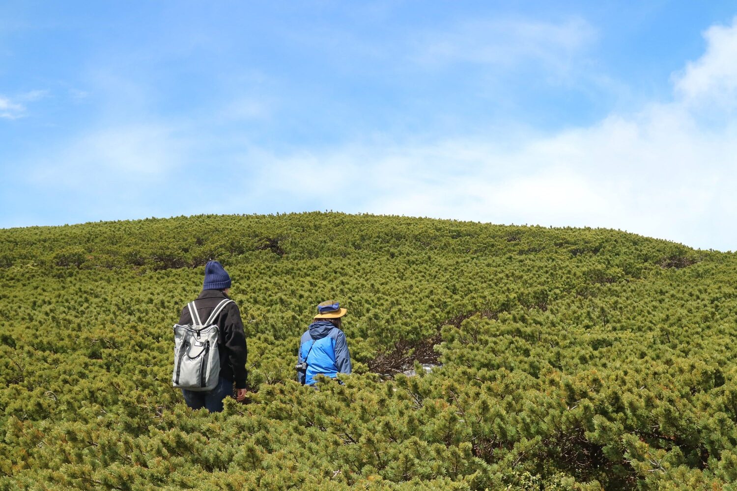
標高2,500mが森林限界で、この標高では背の高い木は生育することが出来ず、低木のハイマツが目立ってきます(ほおのき平を出発して約30分)。
高山市内から乗鞍岳を眺めると横に一本線が見えます。これが乗鞍スカイラインの森林限界付近です。このあたりを通ると、下がダケカンバ、上がハイマツとはっきり分かれている不思議な景色を見る事ができます!
高山植物の宝庫!
乗鞍畳平のお花畑は高山植物の宝庫です。30種類以上の高山植物が生育しています。7月になると一斉に可憐な花が咲き始め、花の種類にもよりますが9月の上旬まで見る事ができます。高山植物は厳しい自然環境で成長するので、花を咲かせるようになるには気の遠くなるような年月が必要です。中には茎が1ミリ太くなるためには10年以上かかるものもあります。 ※中部山岳国立公園内では植物の採取は禁じられております。乗鞍の自然環境を後世に残すため、節度ある行動をお願いします。
濃飛バスと乗鞍の歴史
濃飛バスは昭和23年(1948年)より乗鞍へのシャトルバスを運行しています。
乗鞍への登山道路(現在の乗鞍スカイライン)は、旧陸軍が高度に対応できる航空機エンジンを開発する試験場を建設するための軍用道路として計画されました。軍はトラックが通れる幅員3mで建設を計画していましたが、濃飛バスの初代社長上嶋清一は、戦争が終わったあとに観光道路へ転用することを考え、総工費42万円のうち個人私財8万円(現在の貨幣価値にして約4億円)を負担することで陸軍を承諾させ、バスの運行許可が下りる3.6mで建設することになりました。
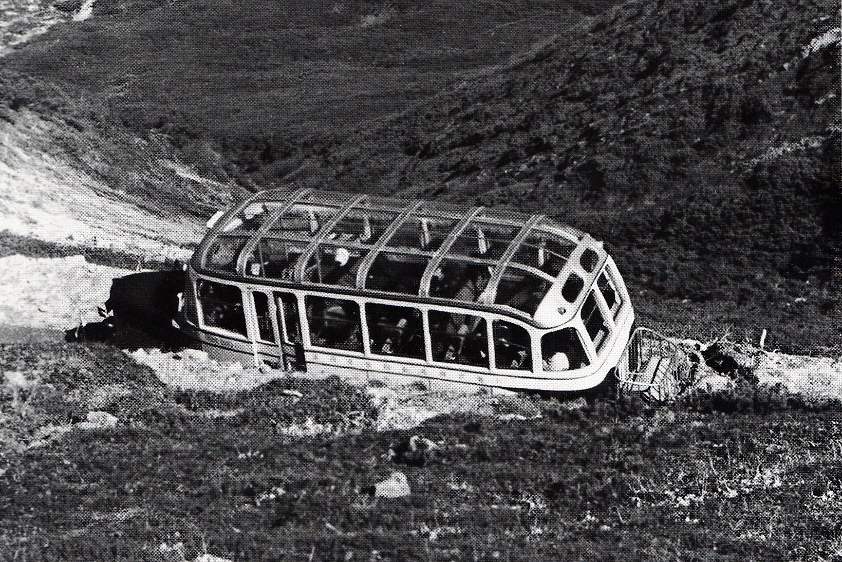
道路は昭和16年(1941年)に着工し難工事の末昭和17年(1942年)秋に開通しましたが、その数年後に終戦を迎え実際に軍用道路として使われることはありませんでした。その後、昭和23年(1948年)7月に乗鞍への路線バスの試運転を行い、日本初の天井全面ガラス貼りの車両「ロマンスカー」が使用されました。この車両は車内から乗鞍の絶景を360度楽しめるようにと特別に開発した車両で、車内から見える景色は抜群でしたが、その当時のバスには冷房の設備がなく、乗車すると夏の直射日光が天井からさんさんと降り注ぎ、乗客から暑いと評判が悪かったため、残念ながら数年で姿を消しました。
開通当時の乗鞍への登山道路は大変狭く土道で、道路上には石がゴロゴロと転がっており、車掌が降りて石を除けながら運行することや、ヘアピンカーブでバスが重くて登りきれない時、お客様に押していただく事もあったようです。
昭和25年(1950年)8月に天皇陛下が皇太子の頃、乗鞍への登山バスにご乗車になられたニュースがメディアで大きく取り上げられ乗鞍岳の名が全国に知れ渡りました。また、毎日新聞主催「新日本観光地百選」の山岳の部において、乗鞍岳が4位に入選し登山バスの利用者の増大につながりました。
昭和34年(1959年)には、運行日数が56日で116千人の方にご利用いただいた記録が残っています。しかし、昭和40年代に入り、マイカーが急激に普及し登山バスの利用者は徐々に減少、代わってマイカーの利用台数が増えていきます。昭和42年(1967年)のピーク日には5,600台のマイカーが利用した事もあったようです。
その後、県道乗鞍公園線の大幅改良が行われ、昭和48年(1973年)に山岳有料道路「乗鞍スカイライン」が完成。30年間の有料道路としての運用を経たあと、平成15年(2003年)より道路の渋滞解消と自然環境を保護するためマイカー規制を行い、現在ではバスやタクシー・自転車だけが通行できる道路となりました。